After being charged with the task of conducting the most comprehensive UAS-based inspections in the industry by Norfolk Southern back in early 2016, Virginia Beach-based Hazon Solutions has announced that it has inspected more than 100,000 linear feet of railway bridges.
Over the last year and a half, Hazon has conducted more than 64 complete bridge inspections across the eastern United States, which has left CEO and co-founder David A. Culler, Jr. CAPT USN (ret) extremely pleased.
“We're very proud to announce this remarkable milestone,” Culler says.
UAS
UAS

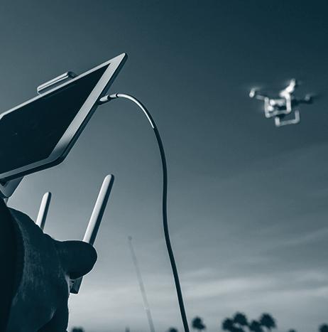
Sharper Shape providing new UAS inspection service for electric utilities
A company that provides UAS-based inspections called Sharper Shape Inc. has announced that electric utilities can now utilize the company’s new automatic detail inspection (ADI) service.
The ADI service has completed field trials, and it is available as a “complete end-to-end inspection package.” Companies also have the option of using their own aircraft and personnel, and can use Sharper Shape’s ADI “Drone Software as A Service” to “maximize the efficiency of their in-house drone operations.”
WhiteFox demonstrates DroneFox technology during Joint Interagency Field Experimentation program
During the Joint Interagency Field Experimentation (JIFX) program from July 31 to August 4, WhiteFox Defense Technologies, Inc. demonstrated its DroneFox technology to a diverse group of U.S. military leaders.

UAS maintenance network Robotic Skies raises a round of venture capital financing
Robotic Skies, which is a UAS maintenance network, has raised a round of venture capital financing, which was led by Kickstart Seed Fund of Salt Lake City, Utah, and also included participation by Sun Mountain Capital of Santa Fe, New Mexico.
According to Robotic Skies, the capital will expedite the “expansion of the Robotic Skies maintenance network for high-end commercial unmanned aircraft systems.”
“We are very excited that this group of experienced investors recognizes the unique solutions that Robotic Skies brings to the emerging unmanned aerospace market and decided to join our team,” says Robotic Skies CEO Brad Hayden.

Small UAS used during aircraft crash exercises at Edwards Air Force Base
During two aircraft crash exercises on July 31 and August 3, members of the 812th Civil Engineer Squadron teamed with the Emerging Technologies Combined Test Force (ETCTF) to “increase their emergency response capabilities” using small UAS.
Through the exercise scenario, the Edwards Fire Department at Edwards Air Force Base in California, and the 812th Explosive Ordnance Disposal (EOD) Flight were able to respond to a simulated crashed B-52 Stratofortress on Rogers Dry Lake.
The exercise allowed responders to approach an actual dismantled B-52 on the lakebed, and the B-52 was also used as an “aerial photo calibration target and later a radar target.”

Mohave Community College to offer UAS degree starting in 2018
Starting in 2018, Mohave Community College in Kingman, Arizona will offer an unmanned aircraft systems degree at all of its campuses.
According to Havasu News, the degree program, which is suited for the “Xbox generation and its fascination with all things tech” according to Andra Goldberg, MCC computer information systems faculty, will prepare students to pursue a UAS Bachelor of Science degree, or to earn entry-level employment in a plethora of industries that use UAS.

Canada’s Regina Police Service Traffic Unit receives DJI Phantom 4 UAS
In Regina, Saskatchewan, the Regina Police Service (RPS) Traffic Unit hopes to soon begin using a new DJI Phantom 4 Pro UAS for a variety of tasks, after the RPS received the unmanned system in early August.
Before the RPS Traffic Unit can use the UAS, Transport Canada must first certify the RPS for UAS use. That process has already started.
If and when the UAS is eligible to be used, there will be several use cases for it according to Constable Curtis Warnar.
“Say if we were doing a scene here and you had some skid marks or roadway evidence, you’re only seeing one angle versus when you can get up in the air and see the full picture,” Warnar says via Global News.
3D Robotics’ Site Scan now includes ground control points
3D Robotics (3DR) has announced that ground control points (GCPs) are now available to be processed in its Site Scan UAS data platform for engineering and construction.
GCPs are “easily-identifiable markers on the ground of a jobsite that can be used to ‘georeference’ drone maps and models,” which makes it possible to not only increase the absolute accuracy of UAS data, but also creates superior deliverables such as orthomosaics, point clouds, and more.
“Ground control points are a game-changer for Site Scan,” says Chris Swigert of Liberty Excavators.
“Now, I can easily tag and process GCPs in the cloud, and deliver my clients more accurate drone maps and models than ever before.”
