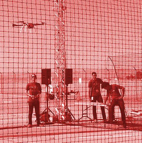
The Virginia Association of Counties has awarded the Loudoun County Sheriff’s Office (LCSO) Small Unmanned Aircraft System (sUAS) program with a 2018 Achievement Award as a model local government program.
The LCSO was the first agency in Virginia, and just the sixth in the U.S., to have a small UAS equipped with a Project Lifesaver antenna. The Project Lifesaver program is an electronic-based locating system for people with medical conditions—such as Alzheimer’s disease and autism—who have a tendency to wander from home and get lost.
Air
Air
Airbus Aerial aids insurance, firefighters battling California's Carr fire
Airbus Aerial, the startup offshoot of commercial and defense giant Airbus, has been using its analytic tools to help insurance companies and first responders come to grips with California’s raging Carr fire, still only 61 percent contained as of Monday.
Airbus Aerial fuses satellite data with its in-house analytical systems to let insurance companies monitor areas they insure, enabling them to settle claims rapidly — in some cases, before the homeowner even knows their house has burned down.
One insurer logged into AA’s system on Friday and by Saturday had settled about a thousand claims, says AA President Jesse Kallman.
“With the satellite, it’s pretty interesting to be able to triage an entire county,” Kallman says.

Wilhelmsen Ships Service to help develop future UAS regulatory framework for Singapore
Wilhelmsen Ships Service has been selected to help develop the future UAS regulatory framework for Singapore. The company will receive dedicated funding for its shore-to-ship delivery project.
Following a Call-For-Proposal (CFP) by the Civil Aviation Authority of Singapore (CAAS) and the Ministry of Transport, Wilhelmsen Ships Service is one of just four companies to have received the funding.
The CFP seeks to “support the development of systems and technologies to enable innovations within the wide-ranging use of UAS.”

Embry-Riddle uses UAS as part of efforts to restore and preserve living shorelines
Embry-Riddle Aeronautical University recently flew its UAS along the shorelines and above the water at Menard-May Park in Edgewater, Florida to capture high-resolution images and video of this area of Mosquito Lagoon, which is part of the Indian River Lagoon system.
Organized and flown by faculty, staff and students from Embry-Riddle’s Unmanned Aircraft Systems Science program, this aerial reconnaissance survey supports the Riverside Conservancy, which is a non-profit group dedicated to “restoring and preserving living shorelines in southeast Volusia County.”
Airbus' Zephyr S HAPS UAS flies more than 25 days
Airbus Defence and Space has announced that its solar powered Zephyr S High Altitude Pseudo-Satellite (HAPS) UAS has landed after flying more than 25 days during its maiden flight.
The maiden flight, which began on July 11 and is the longest duration flight ever made according to Airbus, proved the system capabilities and achieved all the flight’s engineering objectives. Airbus says that an application has been made to establish this as a new world record.
 UAS has set a new flight duration record after flying more than 25 days during its maiden flight. Photo: Airbus")
Caltech engineers use UAS to herd birds away from airspace at airports
Engineers at the California Institute of Technology (Caltech) have developed a new control algorithm that allows a single UAS to herd an entire flock of birds away from the airspace of an airport.
The project was inspired by the 2009 "Miracle on the Hudson," when US Airways Flight 1549 struck a flock of geese shortly after takeoff and forced pilots to land the plane in the Hudson River off Manhattan.
“The passengers on Flight 1549 were only saved because the pilots were so skilled,” says Soon-Jo Chung, an associate professor of aerospace, and the principal investigator on the drone herding project.
Pierce Aerospace receives USAF SBIR award for its remote identification system for UAS
Pierce Aerospace has received a U.S. Air Force Small Business Innovation Research Grant award for its work on Flight Portal ID, a remote identification system for UAS.
According to Pierce Aerospace, Flight Portal ID has received international attention for its “sensible approach” to solving the industry challenges of identifying UAS, including its recognition by the International Civil Aviation Organization last fall.
Oceans Unmanned expands its freeFLY UAS program to Dutch Harbor, Alaska
In partnership with Alaska Sea Grant and Aleutian Aerial LLC, and with additional support from DJI, Oceans Unmanned Inc. has announced the expansion of its freeFLY initiative into Dutch Harbor, Alaska, to provide UAS aerial support for marine mammal entanglement response efforts in the region.
The freeFLY program, which was launched earlier this year in Hawaii, provides training, equipment, and management oversight to networks of local volunteer UAS operators that are available to support response groups.

Louisiana Department of Environmental Quality finds no shortage of uses for its UAS
The Louisiana Department of Environmental Quality (LDEQ) is utilizing its UAS for a variety of tasks.
Recently, one of the department’s UAS was used to fly over a section of the Mississippi River to document an oil spill that occurred near the French Quarter, while in another instance, a UAS allowed responders to view a flooded field in St. Landry Parish.
When the department deploys its UAS, the UAS records the event in both still images and video, which can then be used for environmental protection and emergency response tasks.
NIAS launches Nevada Drone Center of Excellence for Public Safety
The Nevada Institute for Autonomous Systems (NIAS) has launched the Nevada Drone Center of Excellence for Public Safety (NDCOE) to help save lives and reduce air hazards from UAS incursions.
Located in Las Vegas, Nevada, NDCOE will seek to do this by “empowering a shared safety vision with the FAA’s integration of drones into the commercial air traffic system.”