A few weeks after agreeing to a “wide-ranging strategic alliance” that accelerates the implementation of autonomous vehicles to the streets of London, Addison Lee Group and Oxbotica have launched a 3D street mapping exercise in London’s Canary Wharf.
With the goal of rolling out Addison Lee’s autonomous services by 2021, this mapping process is expected to create the backdrop for new autonomous services that meet urban requirements for efficient transport, reduced congestion and improved air quality.
Along with their partners Canary Wharf Group and insurer AXA XL, Addison Lee Group and Oxbotica have started the mapping process using a vehicle equipped with mapping technology to record every curb, road sign, landmark and traffic light in Canary Wharf’s 128-acre estate.
Mapping
Mapping
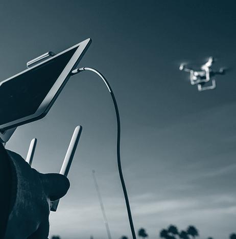
Parrot introduces new end-to-end UAS platform for farmers, agronomists and researchers
Parrot has introduced its Parrot Bluegrass Fields, which is described as an end-to-end agriculture UAS platform that provides farmers, agronomists and researchers with the insights they need to boost the quality of their crops, and maximize yields.
Part of the Parrot Business Solutions portfolio, Parrot Bluegrass Fields is a combination of the Parrot Bluegrass UAS and the all-new ParrotFields mobile mapping app and Pix4Dfields desktop and cloud-based UAS mapping software.
Featuring a robust carbon-fiber structure, the Parrot Bluegrass agriculture UAS has a flight time of up to 25 minutes, and it is built to perform efficient operations, even in confined areas, thanks to its vertical take-off and landing capability.

SenseFly and IN-FLIGHT Data complete historic urban BVLOS UAS project
SenseFly and IN-FLIGHT Data recently completed what they are calling North America’s first urban beyond visual line of sight (BVLOS) UAS project in a major city.
Conducted in Calgary, Alberta, Canada, the project’s goal was to collect mapping data to support the development of a new graveyard site, which will be the first new cemetery in the city since 1940.
Using a senseFly eBee Plus fixed-wing UAS, the IN-FLIGHT Data team mapped the area by conducting a total of 257 miles’ worth of BVLOS operations at an average distance of 1.46 miles from the pilot.

Tippecanoe County Sheriff's Department finds UAS beneficial when conducting crash site assessments
Crash assessments can take a lot of time, but the Tippecanoe County Sheriff’s Department in Lafayette, Indiana has found that UAS can be very beneficial when it comes to conducting crash site assessments.
Lieutenant Robert Hainje of the Tippecanoe County Sheriff’s Department says that the department’s methods of using close range photogrammetry with its camera systems that it has in place causes the department to keep the road way closed down while they take photographic evidence.

SenseFly's new eBee X fixed-wing UAS offers wide variety of camera options and increased endurance
SenseFly recently announced the launch of its eBee X fixed-wing drone, which allows operators to map without limits, the company says.
Part of the Parrot Business Solutions portfolio, the eBee X is designed to boost the quality, efficiency and safety of an operator’s geospatial data collection, as it offers a camera for every job, as well as the accuracy and coverage capabilities to meet the requirements of even the most demanding projects, and the durability to work virtually every site.

Marble's delivery robots hit the ground to map out Arlington, Texas
The first two test robots from Marble, a San Francisco-based robotics company, began mapping out the city streets and sidewalks of Arlington, Texas on Friday, August 17, according to NBC DFW.
Marble is the first company to deploy this type of technology in Arlington after the City Council gave approval for private companies to deploy robotic delivery devices to test their usage in the city back in June.
“This is our first step in interacting with the city of Arlington and we are very excited to be here,” says Marble representative Jackie Erickson.

Global UAV Technologies and others conduct landmark UAS mapping mission in Canada
On June 14, Global UAV Technologies Ltd., InDro Robotics Inc., and High Eye Aerial Imaging Inc. conducted the first UAS mapping mission over a major Canadian metropolitan city, flying over the downtown core of Victoria, British Columbia, Canada.
The mission, which was a first of its kind operation, was completed for the City of Victoria’s Emergency Management Division and conducted alongside members of Transport Canada.

SenseFly's software integration with Trimble optimizes UAS mapping workflow for geospatial professionals
SenseFly has announced a new software integration with Trimble that optimizes the UAS mapping workflow for geospatial professionals, ultimately ensuring the smoothest possible end-to-end mapping UAS workflow.
Within their drone's recently launched eMotion 3.5 software, senseFly operators can now transform a senseFly S.O.D.A. camera’s georeferenced imagery into an “automatically-collated project (in .jxl format).”
This allows for the simple, one-click import of UAS imagery into the Trimble Business Center Aerial Photogrammetry module, without having to manually create a project and organize images.
RIEGL receives MAPPS Geospatial Excellence Award for its LiDAR sensor for unmanned laser scanning
RIEGL, which provides cutting edge technology in airborne, mobile, terrestrial, industrial and unmanned laser scanning platforms, has announced that it is the recipient of the 2017 MAPPS Geospatial Products and Services Excellence Award.
RIEGL received the award for its RIEGL miniVUX-1UAV miniaturized LiDAR sensor for unmanned laser scanning, in the Technology Innovation category at the 2018 MAPPS Winter Conference. RIEGL says that it is “thrilled to be the winner of the MAPPS Geospatial Excellence Award!”
According to the company, the RIEGL miniVUX-1UAV is a “user-friendly and cost-efficient device to acquire survey-grade measurement data” by use of remotely piloted multi-rotor, rotary-wing, or fixed-wing UAVs, for different applications.
Unifly and HERE Technologies partner to enable airspace maps for UAS
Unmanned Traffic Management (UTM) software provider Unifly and digital mapping and location services provider HERE Technologies have announced that they will work together to “jointly enable airspace maps for drones.”
The collaboration between the two companies will consist of two phases.
During the first phase of their collaboration, Unifly and HERE plan to enable an airspace map for UAS that covers both rural and urban areas, and marks out no-fly zones such as airports, residential areas and sensitive government installations.
