First Responders
First Responders

DJI unveils business-themed Mavic 2 Enterprise with added accessories
Dronemaker DJI has unveiled the Mavic 2 Enterprise, a compact, foldable drone with a zoom camera that can be outfitted with accessories such as a beacon or loudspeaker.
The Mavic 2 Enterprise is aimed at businesses, governments, educators and other professionals, the company says, with accessories aimed at boosting its capabilities for firefighting, emergency response, law enforcement and infrastructure inspections.

FLIR announces UAS flight management software platform designed for public safety applications
FLIR Systems Inc. has announced a UAS flight management software platform designed for public safety applications called DroneSense–FLIR Edition.
According to FLIR, DroneSense-FLIR Edition is the only software platform that combines thermal and visual imaging processing with flight data planning and management capabilities across public safety organizations to help improve incident response.
This is the first product under a collaboration between FLIR and DroneSense. DroneSense is a UAS software platform maker based in Austin, Texas that FLIR announced a strategic investment in earlier this year.

State Farm granted waiver to conduct UAS operations over people and BVLOS in areas effected by Hurricane Florence
State Farm has been granted a waiver for UAS operations that will be the first of its kind for an insurance company, and will allow it to assess damage in communities effected by Hurricane Florence.
The FAA has granted State Farm a waiver that combines permissions to conduct UAS flights over people and flights beyond the operator’s visual line of sight. Both of these operations are usually tightly restricted.
These provisions are approved over four states impacted by Hurricane Florence. Together, they will “dramatically enhance State Farm’s ability to evaluate hurricane damage and allocate resources,” the insurance company says.

Orange County, Florida to use UAS to locate people with cognitive diseases if they wander away
In Orange County, Florida, UAS will be used to locate people with a cognitive disease if they wander away from home or a facility.
A pilot program is being spearheaded by state Sen. Linda Stewart, and $75,000 of state money will be used to launch the initiative.
“This technology will help find people much faster than by foot, by car, even a motorcycle,” Stewart says via the Orlando Sentinel.
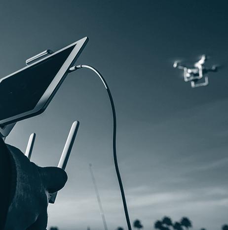
Self-Deploying Drone Pilots may be Problem for Hurricane Response Efforts
Last year’s hurricane season was a benchmark year for the role of drones in emergency management. Harvey, Irma, and Maria all had varying characteristics that served well to showcase the benefits that unmanned aircraft systems can provide for response and recovery operations. However, the well-documented — and publicized — success of those efforts is now likely to create a new problem: well-intentioned remote pilots who self-deploy to disaster scenes hoping to help save the day.
 trains remote pilots for UAS disaster operations during Disaster Camp 2018 in Miami. Photo: Javier Galeano")
Winnipeg Fire Paramedic Service deploys new UAS for first time
The Winnipeg Fire Paramedic Service (WFPS) in the city of Winnipeg, Manitoba, Canada recently deployed its new UAS for the first time to assist with the assessment of a fire and later, the detection of hot spots.
“With the drone’s help, the commander of the scene was better able to critically assess the dangers of this fire and direct the crews to target the fire in a more efficient manner,” explains Assistant Chief Jay Shaw.
“This is a great example of how our department is using technology to increase safety for our crews and also create better outcomes for citizens.”
Airbus Aerial aids insurance, firefighters battling California's Carr fire
Airbus Aerial, the startup offshoot of commercial and defense giant Airbus, has been using its analytic tools to help insurance companies and first responders come to grips with California’s raging Carr fire, still only 61 percent contained as of Monday.
Airbus Aerial fuses satellite data with its in-house analytical systems to let insurance companies monitor areas they insure, enabling them to settle claims rapidly — in some cases, before the homeowner even knows their house has burned down.
One insurer logged into AA’s system on Friday and by Saturday had settled about a thousand claims, says AA President Jesse Kallman.
“With the satellite, it’s pretty interesting to be able to triage an entire county,” Kallman says.

First responders in Effingham County, Illinois use UAS to find runaway juvenile
First responder departments in Effingham County, Illinois recently used a UAS to find a runaway juvenile.
After the juvenile was spotted entering a cornfield, Fire Chief Joe Holomy flew the UAS above the field, and the youth was spotted and contacted. The juvenile was then retrieved by Effingham County Sheriff's deputies, and taken to a local hospital for observation.
According to Police Chief Jeff Fuesting, the UAS proved to be extremely valuable on this day, as it helped save time and reduced the risk of weather-related injuries to both the juvenile and first responders, since the temperatures outside the cornfield were in the 90s that day.
Louisiana Department of Environmental Quality finds no shortage of uses for its UAS
The Louisiana Department of Environmental Quality (LDEQ) is utilizing its UAS for a variety of tasks.
Recently, one of the department’s UAS was used to fly over a section of the Mississippi River to document an oil spill that occurred near the French Quarter, while in another instance, a UAS allowed responders to view a flooded field in St. Landry Parish.
When the department deploys its UAS, the UAS records the event in both still images and video, which can then be used for environmental protection and emergency response tasks.