In support of the firefighting efforts in Northern California by CAL FIRE, General Atomics Aeronautical Systems, Inc.’s (GA-ASI) MQ-9 UAS is being used by the California Air National Guard’s 163d Attack Wing operating out of March Air Reserve Base.
The UAS has full-motion video (optical and infra-red), as well as ground imaging Synthetic Aperture Radar (SAR) capability, which provides clear sight through both clouds and smoke.
“The 163d Attack Wing supports citizens during the fires by operating two missions under approval from the Secretary of Defense and the Federal Aviation Administration,” says Brigadier General Dana A. Hessheimer.
Technology
Technology

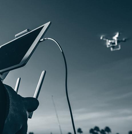
Empirical Systems Aerospace to develop UAS at new manufacturing facility
Aerospace engineering design and manufacturing company Empirical Systems Aerospace, Inc. (ESAero) has opened a new manufacturing facility in San Luis Obispo, California. More than 70 skilled professionals in engineering, production and quality control are expected to work at the new facility, with approximately 40 new jobs being created in the process.
The facility, which includes flexible manufacturing lines, a clean room environment, laboratories, computer centers, test cells and office and conference space, will be used to “design, produce test, and certify” electric and hybrid aircraft, including unmanned aircraft.

Aerovel's unmanned Flexrotor sets VTOL endurance record
Aerovel has announced that its unmanned Flexrotor, named Actaea, set a VTOL endurance record, as it flew just over 32 hours.
During its flight, Actaea, which is a unique miniature tailsitter, transitioned from hover to wing-borne flight, and conducted its journey through a “showery day, a blustery night, and then another day in the breezy and unsettled air behind a cold front.”
The UAS transitioned back to hover as dusk fell, and “dropped gently down onto a 12-foot square helideck underway at 8 kt.”
The UAS flew for a total of 32 hours and eight minutes, and had more than three hours’ worth of gasoline left in its tank upon landing. When it took off, the UAS had 7.5 kg of fuel onboard.

Michael Baker International purchases Altavian Nova UAS
A global leader in engineering, planning and consulting services, Michael Baker International has announced that it has expanded its growing UAS fleet with the purchase of an Altavian Nova fixed-wing UAS.
The company says that the UAS, which can fly up to 90 minutes and cover 600-800 acres in a single flight, will be used to conduct “aerial inspections and mapping of large sites or during inclement weather conditions.”

Weekend Roundup
This Week in the Unmanned Systems and Robotics World
NBA superstar LeBron James is headlining a broadcast and digital ad campaign that seeks to build trust in autonomous vehicles. Produced by Intel, the first ad shows James expressing hesitation about riding in a self-driving car. After being convinced to take a ride in the vehicle, James gives his approval of the technology at the end of his ride, saying “hey yo, I’m keeping this,” by the end of the ad. (The Verge)

Rajant and AlarmTransfer show UAS can reduce the time it takes for authorities to respond to a verified home alarm
If alarm companies use UAS to supplement their current infrastructure, the amount of time it takes for authorities to respond to a verified home alarm can be significantly lowered, according to a Malvern, Pennsylvania company called Rajant, which provides private wireless networks, and Norman, Oklahoma’s AlarmTransfer.
The national average time it takes for authorities to respond to a verified home alarm is seven minutes. Through their tests using UAS, Rajant and AlarmTransfer showed a home alarm company can get aerial surveillance on the scene as quickly as 30 seconds.

Australian Institute of Marine Science uses Wave Glider USV to monitor Great Barrier Reef
The Australian Institute of Marine Science (AIMS) and Boeing recently used the Liquid Robotics-developed Wave Glider USV to complete a seven-day open water mission, which was the “first major milestone of a five-year joint research agreement” between the two companies.
The mission, which covered 200 nautical miles including parts of North Queensland’s Great Barrier Reef, showcased how the Wave Glider could evaluate the health of the coral reefs and ecosystems.
SINTEF, NTNU and others developing robotic systems that could handle tasks at fish farm facilities
In the future, autonomous and remotely operated systems could play a major role in conducting different tasks at fish farm facilities, being that the industry is “planning to locate facilities in more open waters where weather and sea conditions are harsher,” which would make certain operations more demanding.
Day-to-day tasks on fish farm facilities, such as fish welfare monitoring, facility inspections, control of feed rationing and lice counting, are currently conducted by several crew on board service vessels.

NVIDIA unveils world's first AI computer designed to drive fully autonomous robotaxis
NVIDIA has unveiled the world's first artificial intelligence computer, codenamed Pegasus, which is designed to drive fully autonomous robotaxis that can transport passengers to their destinations, and provide mobility to everyone.
Designed for ASIL D certification—the industry's highest safety level—Pegasus extends the NVIDIA DRIVE PX AI computing platform to handle Level 5 driverless vehicles.
NVIDIA says that the NVIDIA DRIVE PX Pegasus will “help make possible a new class of vehicles that can operate without a driver -- fully autonomous vehicles without steering wheels, pedals or mirrors, and interiors that feel like a living room or office.”

UAS used to map damage done to Holiday Beach, Texas by Hurricane Harvey
In the aftermath of Hurricane Harvey, Texas A&M University-Corpus Christi—commonly known as the Island University—used UAS to map Holiday Beach, Texas.
The map, also known as an “ultra-high resolution ortho-mosaic image,” was created using the data collected by the UAS, and it is available on the school's website.
“Disaster sites are not easily accessible due to debris and other obstacles, so we’re hoping that collecting ultra-high-resolution aerial maps from UAS can significantly help,” says Dr. Jinha Jung of the Island University's Department of Engineering and Computing Sciences.